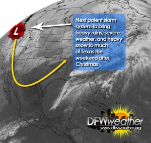
Satellite image for December 24, 2015 depicting next potent upper-level storm system, to affect the area the weekend after Christmas, coming ashore in the Pacific northwest.
For those wanting a taste of winter, the exceptionally warm weather we have been experiencing for the last several weeks is about to come to an abrupt end. Unfortunately, this will not be in time for Christmas. Expect unseasonably warm conditions to persist the next couple of days.
A strong upper-level storm system is now entering the Pacific northwest. This will be our next major weather maker for not only us, but much of Texas as well. This system is expected to dig down into the desert southwest and strengthen and become a closed low. It will continue digging into northern Mexico, and then, swing east northeast across Texas over the post-Christmas weekend. A deep trough will envelop much of the Western CONUS and allow a big chunk of Arctic air to spill southward along the lee of the Rockies. This strong, Arctic cold front will begin moving across Texas on Saturday and reach the DFW area in the very early hours on Sunday morning while spreading a shallow, low-level Arctic airmass in its wake. The coldest air so far this season will follow the passage of this front and bring an abrupt end to our warm weather pattern.
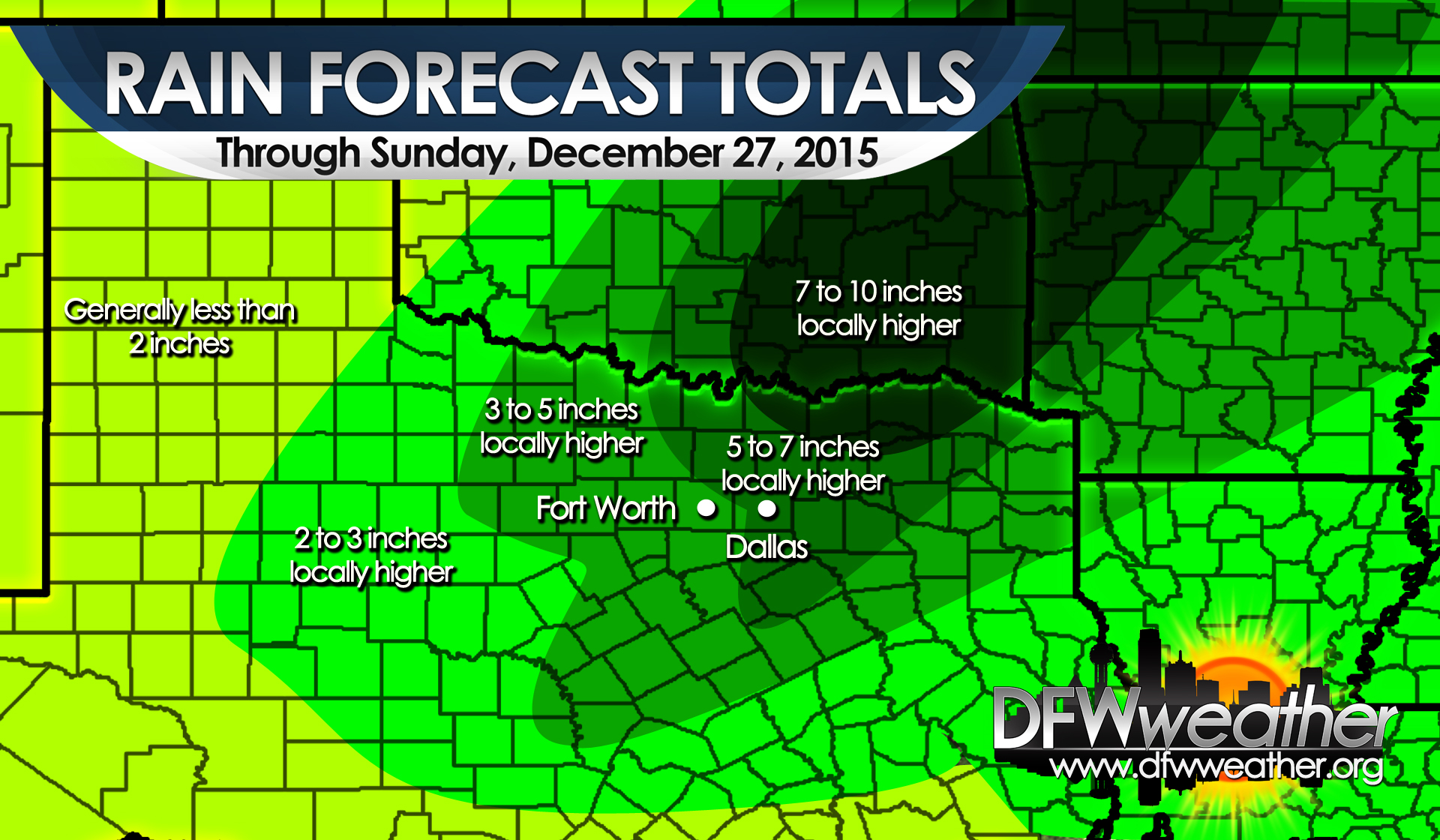
Out ahead of the upper-low, strong southwest flow aloft and southerly flow at the surface will advect warm moisture laden air into the region. PWATs (precipitable water) will climb to the 99th percentile for late December across the area. What this means is the potential for another very heavy rainfall event for our area on Saturday into Sunday. It is too early to pinpoint exact amounts, but rest assured it does look like another multi-inch rain event for our area. This will promise to bring already extraordinary annual rainfall totals above the 60 inch mark for DFW. In addition to the heavy rainfall, areas east of the I-35 corridor will have the potential for severe weather with this system. Nearly all modes of severe weather will be possible. More details on the severe weather will unfold in coming days as we have a better idea of mesoscale parameters.
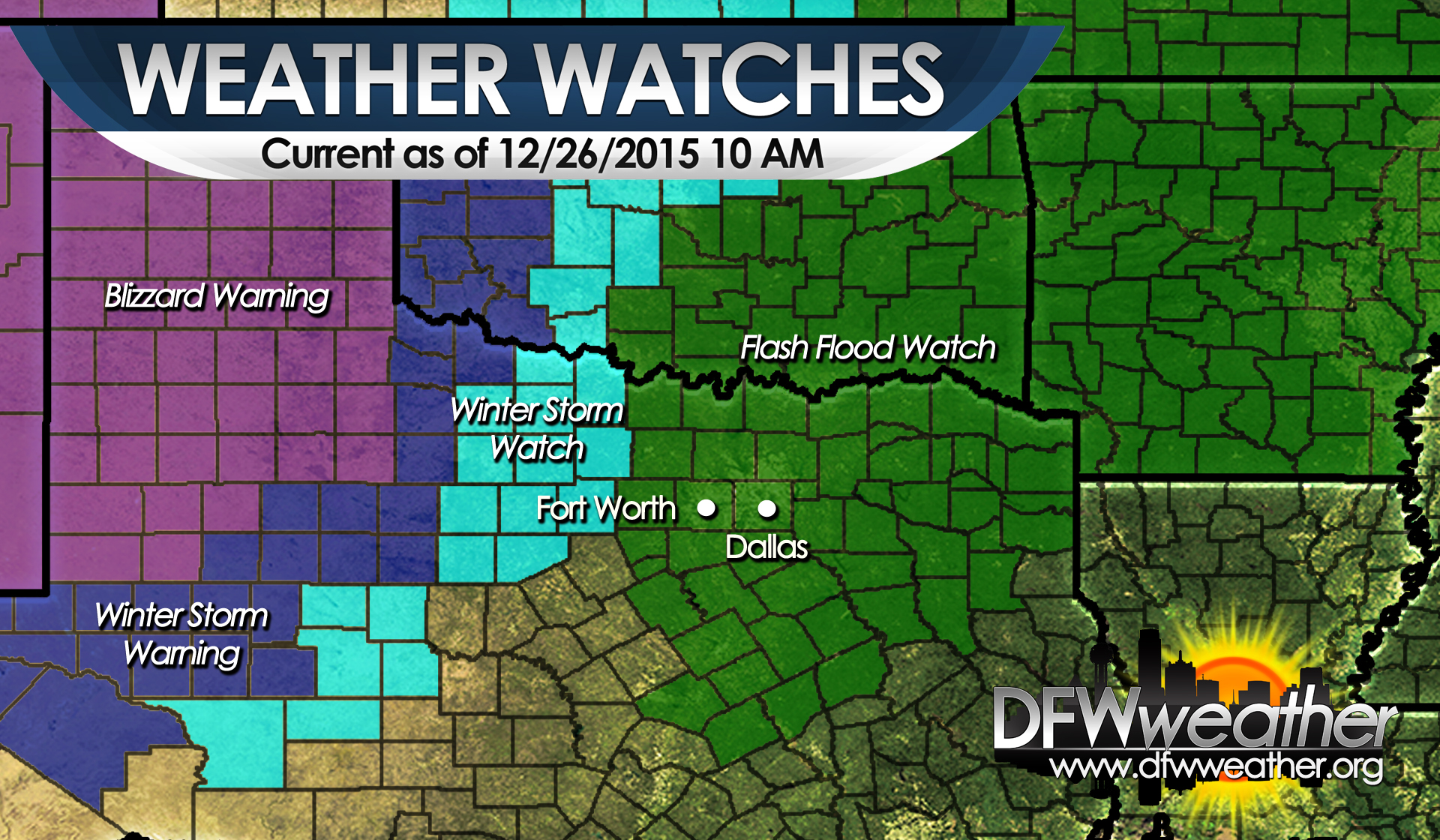
While we have rain in our area, much of west Texas will be experiencing what may become a historical blizzard for that region. Very heavy snowfall is expected in that part of the state with some potential for major accumulations. Near blizzard to blizzard conditions will be possible across much of West Texas from the Permian Basin into the Texas Panhandle. Winter Storm Watches have already begun posting for that part of the state. Travelers heading into that region should be extremely cautious of the weather and plan to make alternative travel plans.
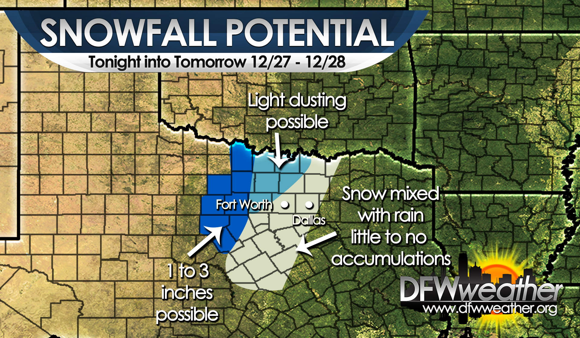
The snow may begin to spread into the western half of North Texas Sunday night into Monday, as the cold air deepens in our area due to the track of the upper-low passing nearly over top of the area. Rain may begin to mix with or change to snow as far south as the DFW area during this time frame. This is all dependent on the exact tract of the low and where the dry slot sets up with this system. Any deviation to the northwest of the tract of the low will keep the cold air warm enough for the precipitation to remain all liquid in our area. If the low moves further south or southeast, then a changeover to all snow could produce some minor impacts to our area. Stay tuned as this part of the forecast could change significantly.
Lows by Tuesday morning will likely drop into the 20s most areas with temps struggling to make it into the 40s for Monday and Tuesday.