
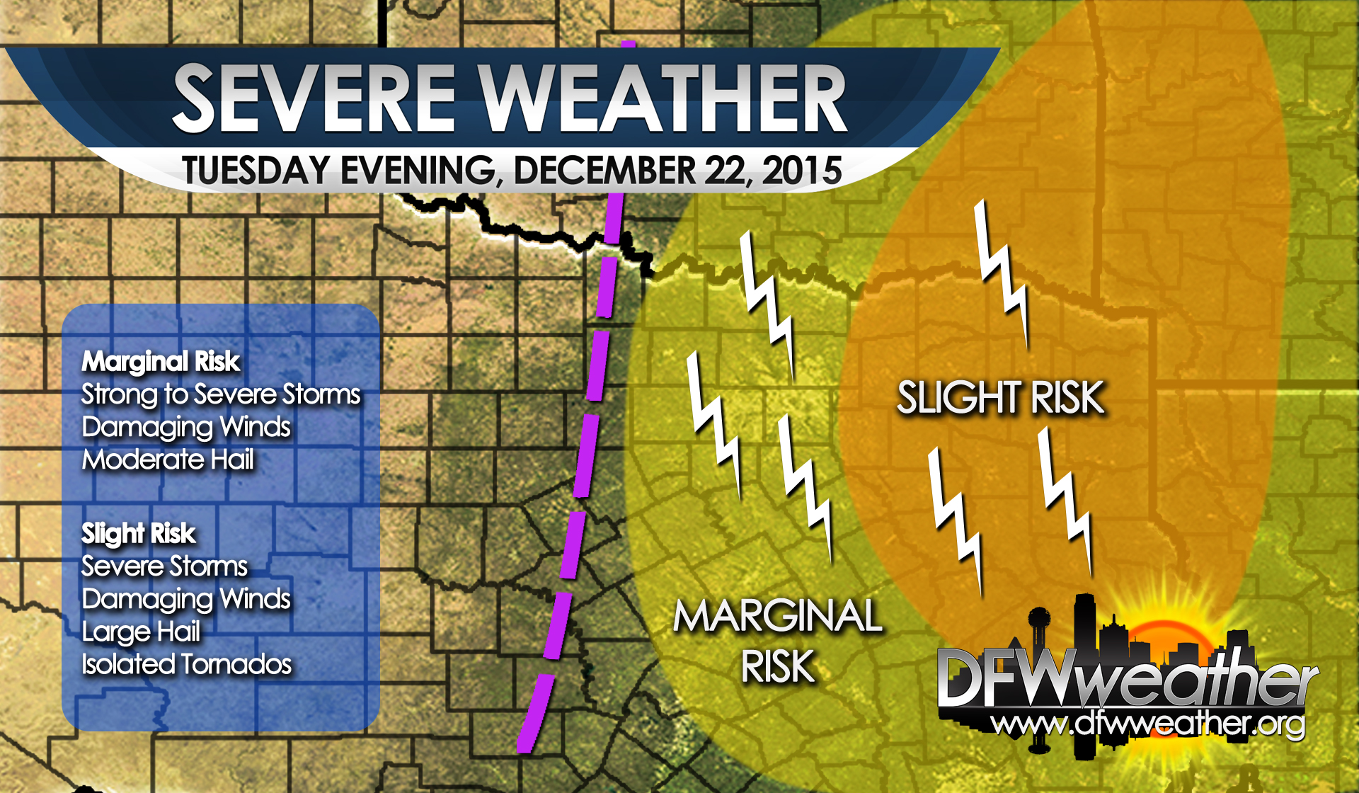
A rather strong shortwave trough will approach the area this evening on a negative tilt providing lift for scattered convection across the area. The latest hi-res models are keeping most of the storms that fire with this disturbance east of the Metroplex, but there is a marginal threat for severe weather for any storms that can overcome the cap. For the Metroplex, the storms look to be mostly elevated limiting the severe weather threat, provided the cap can be breached. Strong to severe storms are possible with the main threats being damaging winds around 50 mph to 60 mph and moderate sized hail. As the storms push east, or further eastward development occurs, conditions are little more favorable for severe weather as the storms can become surface based. Adequate instability in the 1000 to 2000 J/Kg range and shear combined with lapse rates in the 6 to 7 C/km range leads to a slight risk area for severe weather. Storms will be able to produce damaging winds in excess of 60 mph, large hail, and pose an isolated tornado risk. This slight risk is noted in the orange color in the map below and should mostly be east of the Metroplex. As this disturbance races off to the northeast, the threat for storms will diminish after 3 am.
Severe weather threat for Tuesday evening, December 22, 2105