
As our much advertised vigorous upper-level storm system moves across the area this evening, rain will become mixed with sleet and snow from west to east in the areas depicted in the map below. The highest accumulations are expected mostly outside our extreme western counties where 1 to 3 inches are possible and a Winter Weather Advisory has already been hoisted by the National Weather Service office in Fort Worth. A dusting to under an inch will be possible in our northwestern counties. Closer in to the heart of our forecast area, wet snow flakes will be mixing in with the rain with a brief window for a transition to all snow early tomorrow morning before precipitation shuts off. However, temperatures will be at or above freezing and coupled with recent warm grounds, we expect little to no accumulations in these areas.
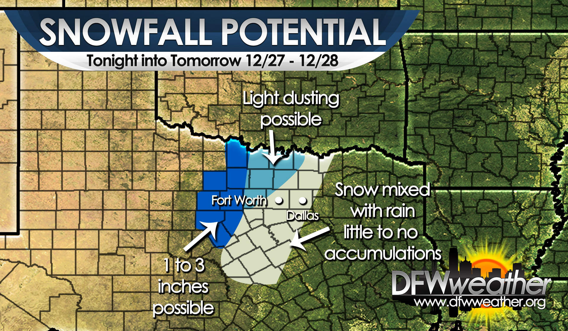
Snow will begin mixing with sleet and rain this evening across the areas shaded above. This graphic shows where we expect accumulations.