
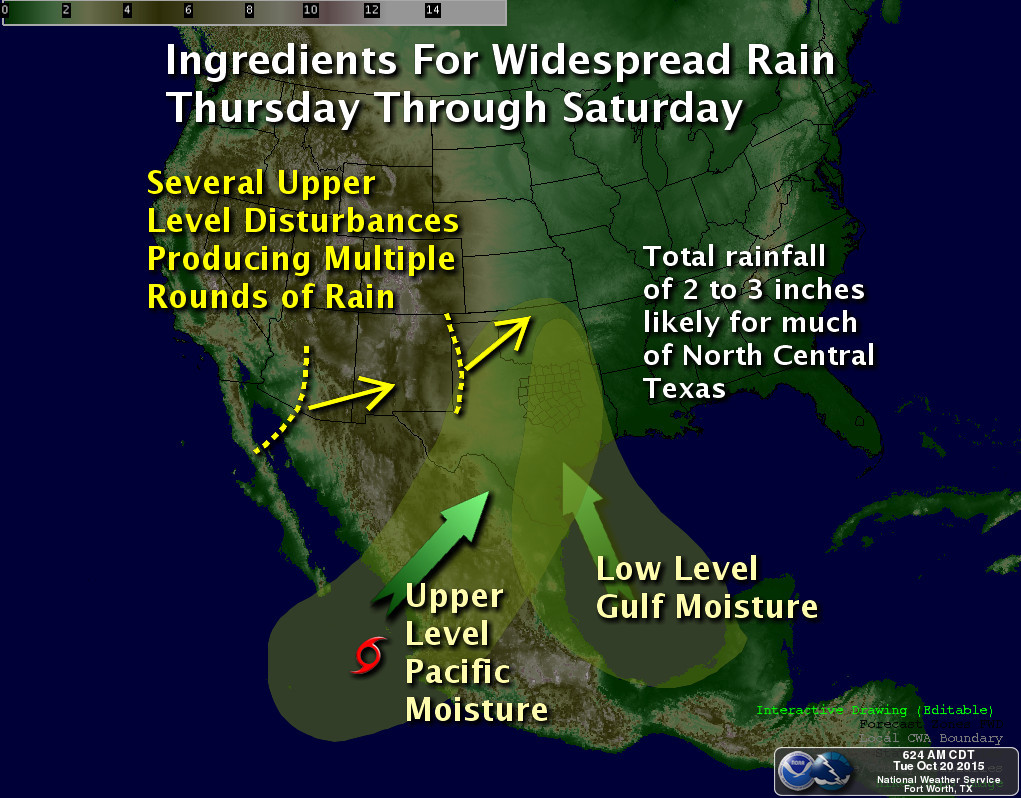
Setup for major rain event unfolding for DFW for Thursday through Sunday. Map courtesy of the National Weather Service, Fort Worth, Texas.
UPDATE: It appears that everything is lined up for two episodes of heavy rain, one tonight into tomorrow, and another tomorrow night into much of Saturday. Forecast rain amounts, when all said and done, will be a widespread 3 to 6 inches of rain across the forecast area with isolated amounts approaching, or even exceeding, 10 inches. It is too hard to determine where the heavier, narrow bands of really intense rainfall will setup, or what areas will see the most training of storms, but these are the areas that will receive the most amounts of rain. A Flash Flood Watch has already been hoisted by the National Weather Service office in Fort Worth that includes all counties covered by this website. Please stay alert to changing weather conditions, and remember, don’t drive your car into flooded roadways.
It has been quite some time since DFW recorded multi-inch rains or had a protracted rain event, but it appears the ingredients are coming together for a major, protracted rain event later this week. An upper-level low is going to slowly eject east northeast from the desert southwest onto the plains. As it does so, tropical moisture gathering near the Yucatan (was once projected to form into a tropical system by the models, now will not) will be advecting northward into North Texas. In addition, what will be a named storm, Patricia in the Pacific, her remnants and moisture will get absorbed northward into Texas this weekend allowing pWATS to climb to 2 inches, a good two standard deviations above normal for October. Another disturbance will quickly move in on the heels of the desert southwest upper-low dragging a cold front with it providing additional lift Saturday and Sunday. All this points to a heavy, protracted rain event beginning as early as Thursday and lasting through Sunday for the forecast area. It is too early to nail down just how much rain we will receive, but indications are that this will be a widespread multi-inch rain event for the area.