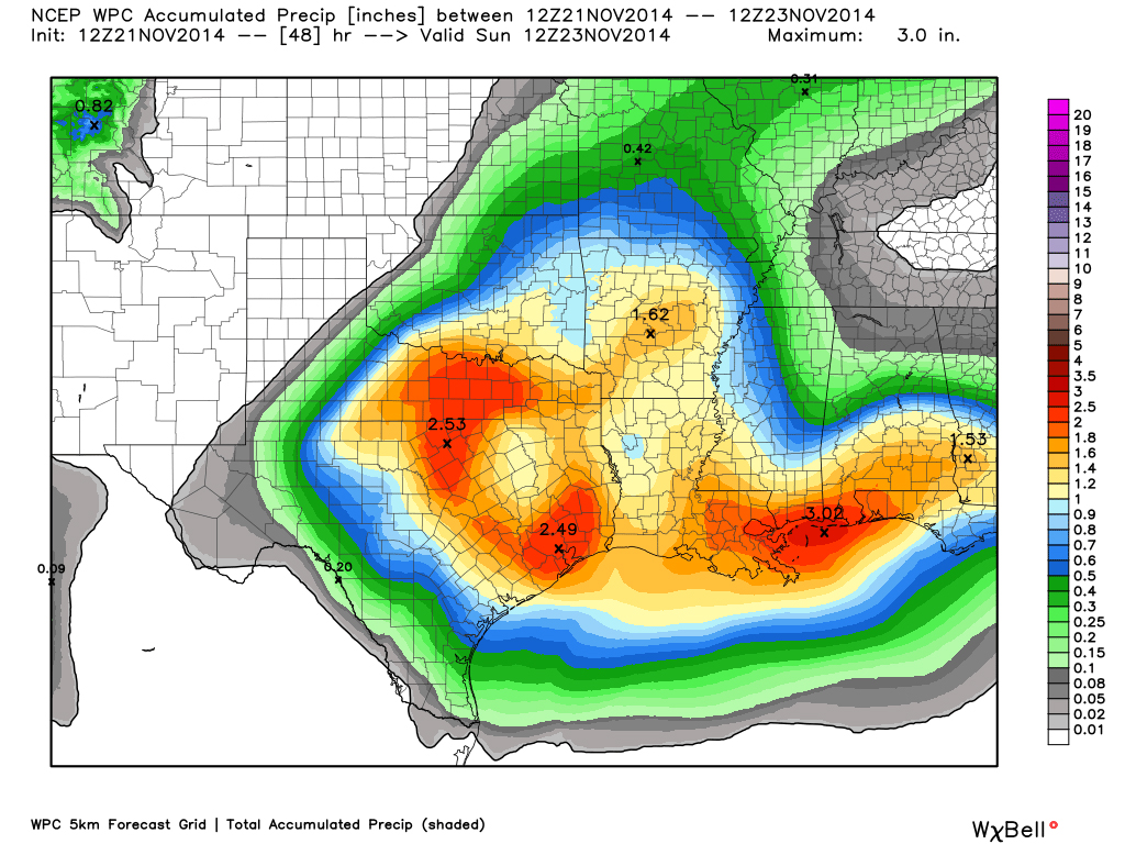
The storm system that brought much needed rainfall to DFW has pushed over to the northeast. In its wake, skies were clear with some patchy fog in some locations which should quickly burn off this morning. Rainfall totals were less than what we forecasted as the system took a much further south track than we thought. However, we did get much needed rainfall across the area, but not everyone saw over an inch of rain as we had hoped with our western and southern counties seeing the most precipitation. Please see the pic for a radar estimate of storm totals.
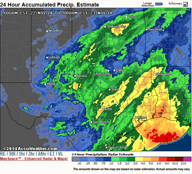
Radar estimate of rainfall totals over the last 24 hours. Courtesy of Accuweather.
Another deepening storm system in Colorado will tighten the pressure gradient causing our winds to pick up out of the west today and become quite gusty out ahead of a cold front. High temperatures are going to be very tricky today as compression warming from the front and westerly component to the wind will support a substantial warm-up in the upper 70s. However, the ground is still very wet and will help to offset the warming a bit. Therefore, the official DFW Weather forecast went with the cooler guidance number for highs today in the middle 70s.
The cold front will bring temperatures down a good 15 degrees tomorrow with more seasonable weather. This will setup a beautiful Thanksgiving week for North Texas with seasonal weather. Computer model guidance is showing temperatures rebounding well into the 70s for the Thanksgiving weekend. Last week, it looked like we were going to get another surge of Arctic air, but over the weekend, the models back off this scenario. While here at DFW Weather, we are going for the warmer weather scenario for the official forecast, this forecaster will caution that Arctic air is damming up on the models in Oklahoma and Texas Panhandles. In this type of situation, usually the cold air wins out, and we do get a some sort of frontal passage. This is due, in part, to the fact that cold air is very dense and tends to sink south against the mean flow, and to the fact that models have a hard time in general with placement of shallow/dense-low level cold air. This is something to definitely watch, and the forecast could change drastically next weekend.