
Tropical Storm Bill is bearing down on the Texas coast this morning near Matagorda Bay. Tropical Storm Warnings are now in effect along the Texas coast. Tropical Storm Bill is currently located as of 7:00 am at 28.2N latitude and 96.0W longitude with maximum sustained winds of 60 mph and a central pressure of 997 mb. It is heading to the northwest at approximately 13 mph. Most model guidance then turn this north toward the DFW Metroplex. The heaviest rains will be to the east or right of the center of circulation as it moves north and eventually northeastward. The latest guidance is unanimously coming into agreement that it will track along the I-35 corridor or just to its west. This puts most of the DFW Metroplex in a position to see heavy rainfall beginning as early as Tuesday evening and lasting through Thursday night. In addition, most of the Metroplex will be in the favorable quadrant to see tropical tornadoes. Obviously with the record rains set in May, our ground will not be able to absorb a lot of additional rainfall, thus Flash Flood watches are already in effect for all of the forecast area as both flash flooding and flooding will be possible. Widespread 4 to 6 inches of rain will be possible in and around DFW with locally 8 to 12 inches possible where the center of circulation tracks and where any heavier rain bands train. Residents of North Texas should stay alert to the latest forecast regarding this hazardous weather situation.
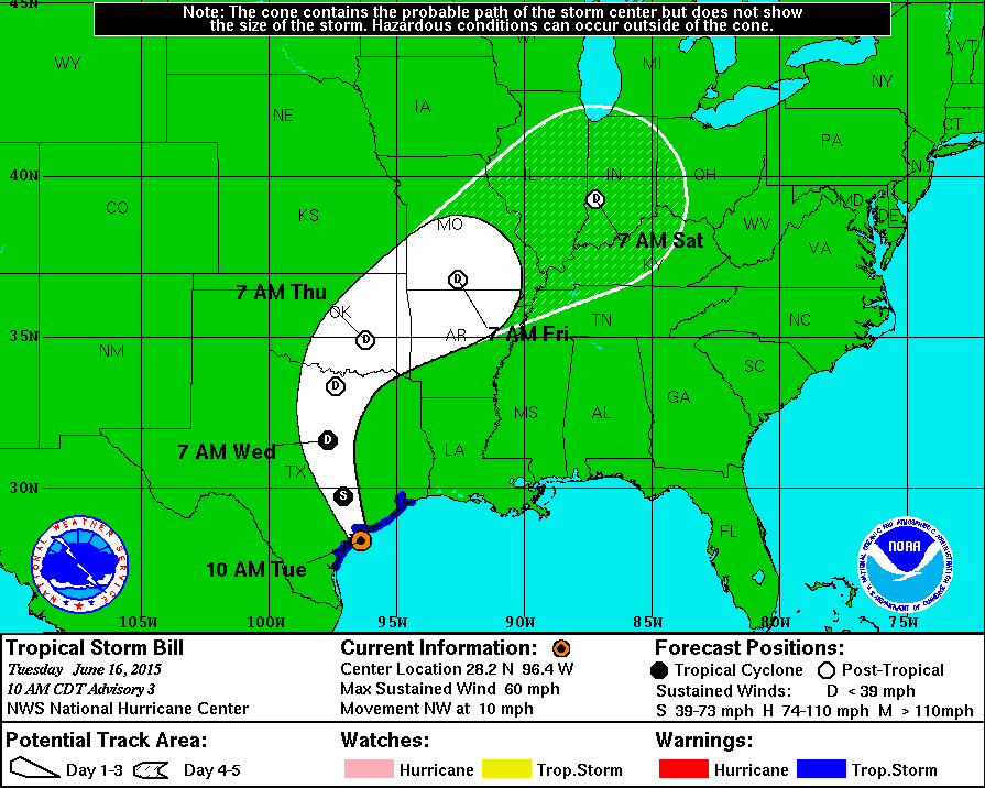
National Hurricane Center latest track on Tropical Storm Bill