Tag Archives: Warming

ANOTHER STRONG MID-WEEK COLD FRONT BEFORE MUCH WARMER WEATHER THIS WEEKEND

An upper-low over northeast Mexico has been responsible for cloud cover today across much of Texas and rain in South/Central Texas. This will continue to track along southeast Texas overnight. In the wake of this system, a strong cold front will be pushing down the Plains arriving in North Texas tomorrow evening. Temperatures out ahead of the front will be able to climb into the 60s for highs tomorrow. After the front arrives, gusty northerly winds of 20 to 30 mph will usher in much colder temperatures with the mercury rapidly falling into the 30s. Highs on Thursday will struggle to reach the low 40s. There may be some drizzle just behind the front, but moisture looks very limited. Thus, don’t expect much, if anything.

After that, a rapid warm-up is in store for North Texas with a beautiful weekend to boot! Upper-ridging will dominate the weather pattern with H85 temps progged to get as high as 16°C by Saturday. This will push surface temps to near 80°F across the area, especially west of the Metroplex. Another cool front arrives on Sunday with somewhat cooler air expected the first of next week. The weekend should be sunny and dry, so get out and enjoy!

RAIN CHANCES RETURN TO DFW WITH WARMING TEMPS

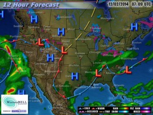
Current weather map for December 2, 2014, courtesy of WeatherBell.

Current weather map for December 2, 2014, courtesy of WeatherBell.

The Arctic airmass that has settled across DFW and the rest of North Texas on Monday will begin to erode, as the Arctic high slides east and a rather intense warm air advection pattern begins. Our winds will become south/southwesterly today and back more south/southeasterly tonight. This will allow warmer air to begin overriding the colder air at the surface. Well after midnight tonight, areas of fog and drizzle will begin to develop across the forecast area. Some of the fog could be rather dense at times with visibilities below 1 mile.  The fog and drizzle will be very slow to burn off on Wednesday and will hang in for much of the morning. Given the pattern, we will keep low chances of light rain showers in the forecast through Friday. Temperatures will begin to warm to near normal, or slightly above, (60s/70s) as we head into the middle and latter part of the week.

By Friday, rain chances will increase as a shortwave  approaches (courtesy of weakening upper low moving ashore off the California and Oregon coast) in conjunction with a cold front from the north. Widespread rain will be possible with isolated thunder as dynamics increase ahead of this system. The cold front is expected to move across Friday evening with a combination of Pacific and Canadian air. This front will not be nearly as strong as the Arctic front that moved through early Monday morning. However, it will keep temperatures below normal heading into early next week as another stronger disturbance and cold front arrives. This will bring additional rain chances to the region as we head into next week.