
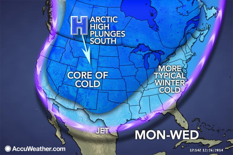
The Arctic gates swing wide open just in time for New Years as a massive 1055+ mb high plunges out of the Northwest Territories of Canada deep into Texas. Map courtesy of Accuweather.
Another Arctic airmass is set to plunge into the United States thanks to a highly amplified pattern. A huge ridge will build into Alaska with 560 dm heights building near 60 N. This will unlodge a dense Arctic airmass sitting over the Northwest Territories, indicative of a 1055+mb high pressure cell moving out of Canada into Montana. This will surge southward along the spine of the Rockies spilling deep into Texas. The Arctic front should arrive at DFW Tuesday morning, if not sooner, bringing with it drastically colder temperatures that will persist through New Year’s Day. At the same time, an upper low will be gathering in the four corners region. Depending on how this ejects out, could lead to precipitation problems across the State…stay tuned! It is too early to pinpoint exact details of just how cold it will be, but right now, New Year’s Eve day and night look to remain below freezing. So, bundle up if heading out to celebrate the New Year. The long-range guidance is pointing to a favorable synoptic pattern setup that could unleash more bitterly cold air as we head into January.