
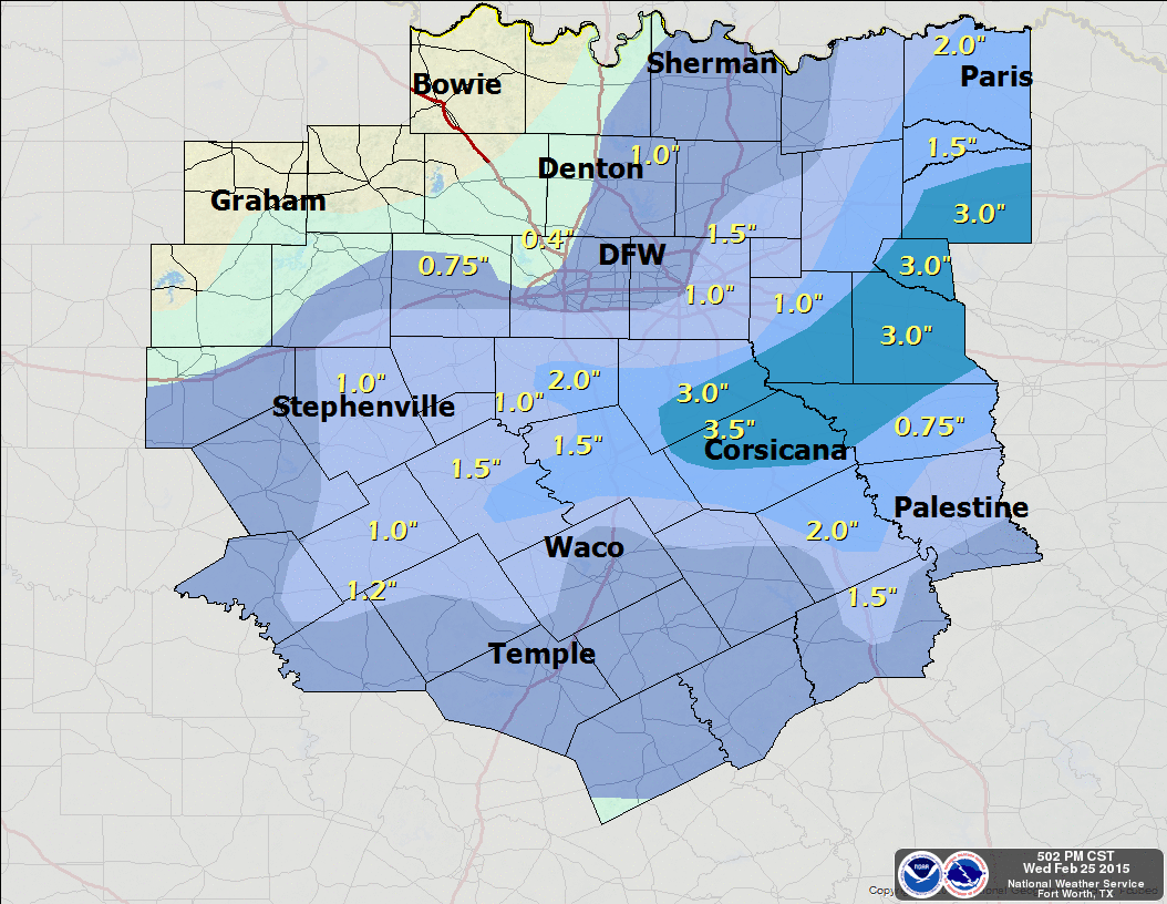
Snowfall totals for the Wednesday, February 25, 2015 snow event. Map courtesy of the National Weather Service office in Fort Worth, Tx.
The upper-low tracking across Texas moved a little farther south than expected. This further south movement allowed temperatures, at about 5000 feet above the surface, to be about 2°F warmer, across the immediate Metroplex and points north, than what they would have been if the core of the low tracked further north. This was enough to effectively have most of the snow that was falling in the upper atmosphere to melt and fall as rain and sleet at the surface. Where the upper low tracked further south, heavier snow did accumulate in a narrow band bound by Hillsboro to Terrell. The heaviest snow was in Navarro County where 3 to 4 inches fell. See graphic above for more detailed snow totals.
The snow/rain/sleet are moving off to the east, and we should see rapid clearing with sun all the way to the I-35 corridor by this afternoon. This will allow temperatures to climb into the 40s this afternoon. Another Arctic cold front is poised to move through the region tomorrow with more snow in the forecast for Friday. Friday’s snow will fall with temperatures in the 20s, but it will be light with not much in the way of moisture or lift because of a weaker wave embedded in the northern jet. Though, there could be some light accumulations.