
We are finally beginning to warm up as the Arctic high releases its grip over North Texas. The Arctic high and trough are moving east allowing our winds to turn around to the south. This will advect warmer air and moisture into the area. You will be noticing warmer temperatures beginning today, with forecasted highs in the 60s and even warmer tomorrow as we climb into the mid-to-upper 60s. By Friday, a strong system will approach DFW in the southern jet enhancing moisture advection out ahead of the system.
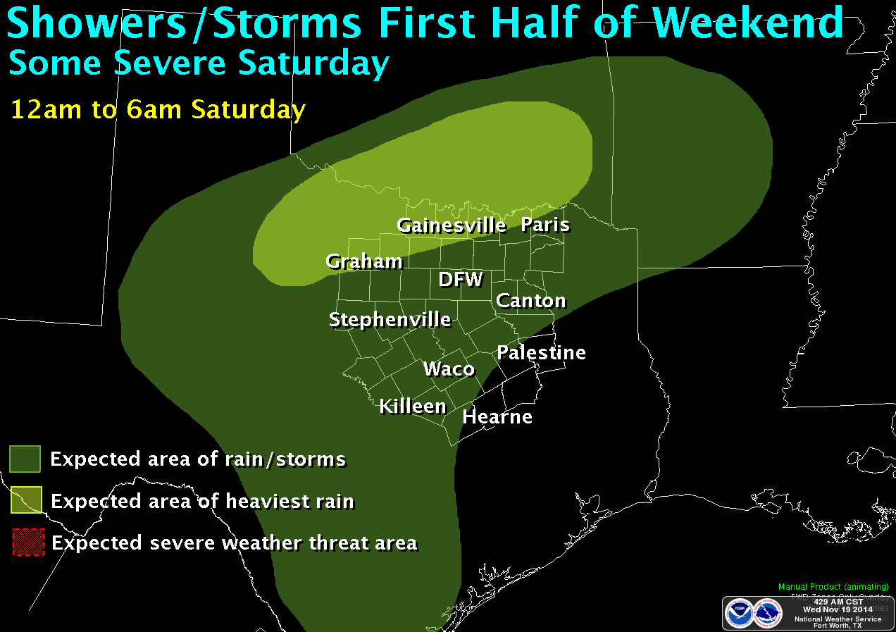
Animation of rain event expected over the forecast area Friday through Saturday. Courtesy of the National Weather Service office in Fort Worth, Texas. Click on the image for the full animation.
This will set the stage for numerous showers and thunderstorms, beginning as early as Thursday night in our northwest counties and area wide on Friday. Some of the showers and storms could produce heavy rainfall, especially on Saturday. Strong to severe weather will also be possible by Saturday, but mainly south and east of the forecast area. This is looking like it could be a multi-inch rain event for the area; however, it is much too soon to pinpoint rainfall amounts. As we get within 24 hours of the event, better data arrives and we will be able to determine more precise rainfall amounts. This is good news as the area does desperately need rainfall.
Don’t get too comfortable with the warmer temps as a cold front arrives on Sunday knocking our temperatures back down. This cold front will not be near as cold as the ones last week. However, things are beginning to come together for another Arctic blast over Thanksgiving weekend. More on that later . . .