
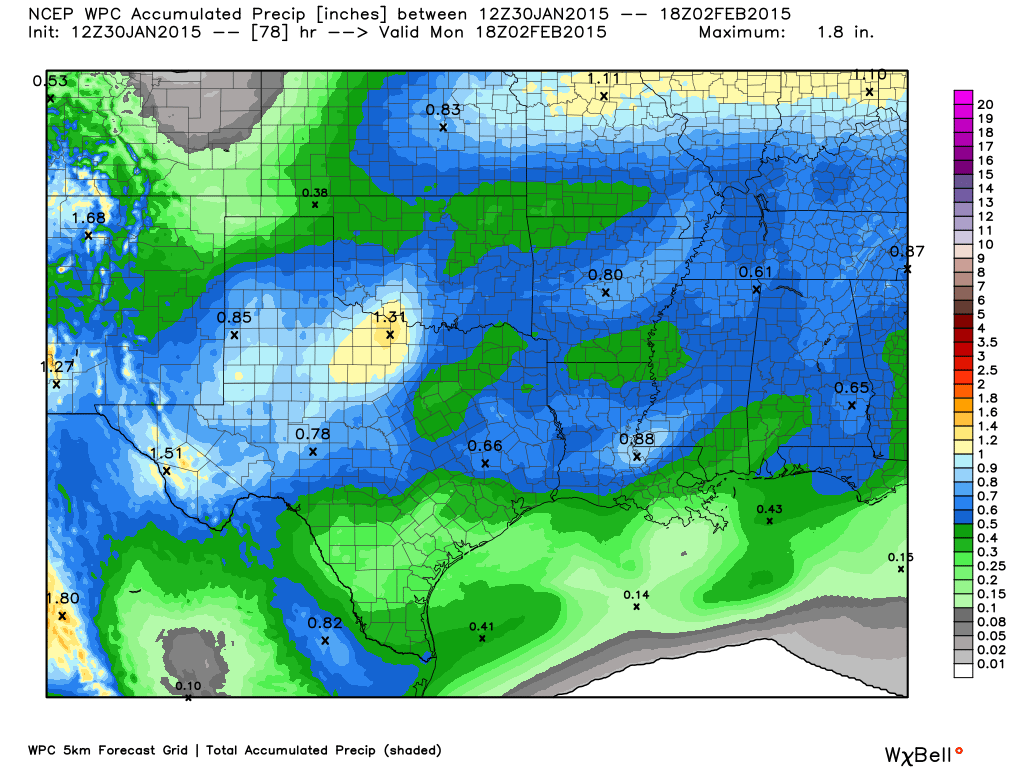
Average rainfall amounts expected for the weekend of January 31st through February 1st 2015. Map courtesy of WeatherBell.
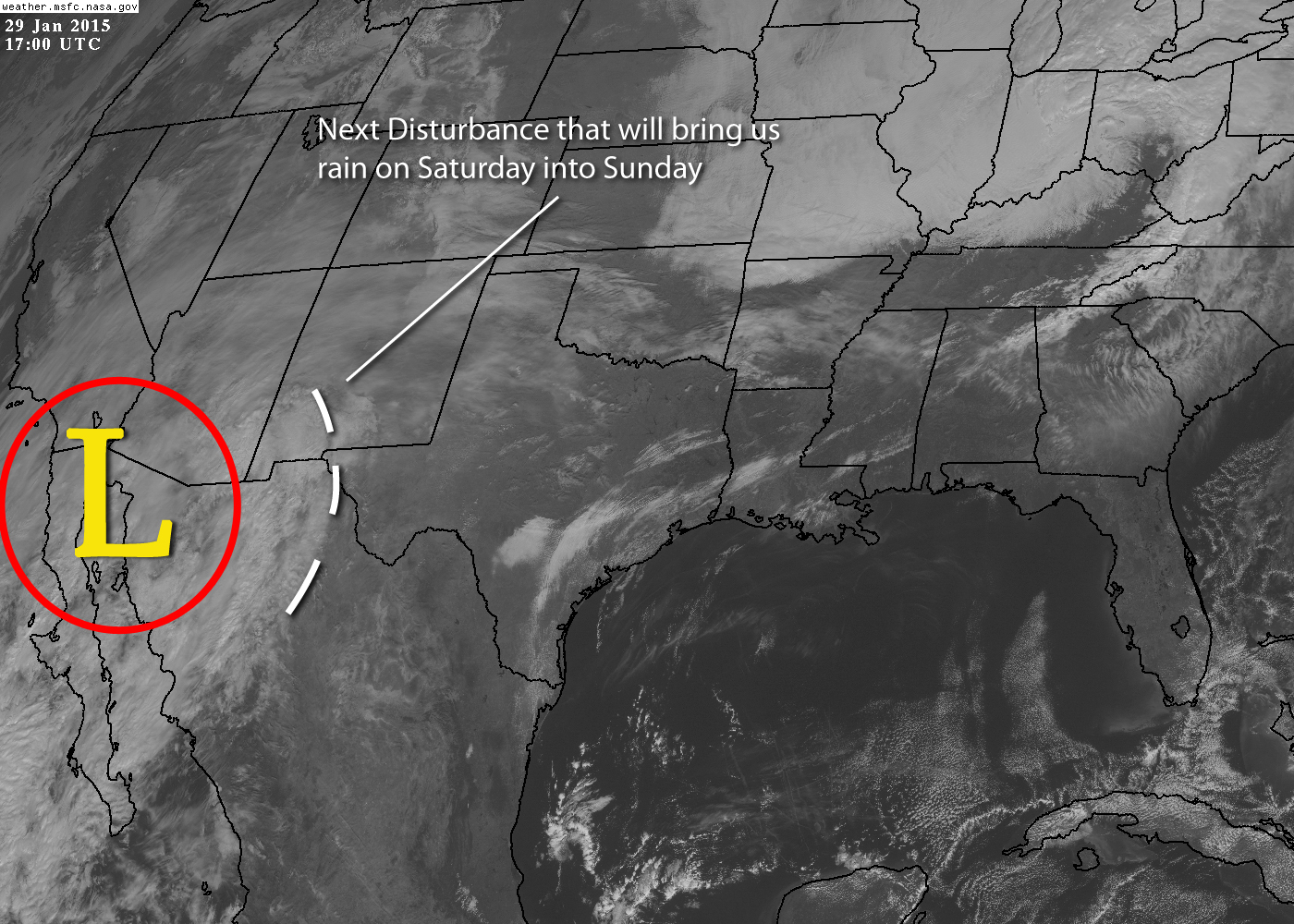
Next weather system to bring much needed rainfall to North Texas Saturday into Sunday.
UPDATE: It looks as though our system that will bring us rain over the weekend is slowing down. Thus, the forecasts have been adjusted back about 12 hours for the onset of precipitation from prior forecasts. In addition, average total rainfall amounts with this system have been lowered to between 1/3 to 1/2 of an inch of rain across the area based on the latest model data. Please see above graphic for latest rainfall amounts expected across Texas.
Our next weather system will be associated with an upper-level low sitting just off the coast of Baja California. The upper-low itself will move eastward a bit before moving south into Northern Mexico. As it does so, it will eject a rather strong upper-level disturbance northeastward into North Texas. This will set the stage for rain to develop from southwest to northeast beginning as early as Friday night. The rain should last into Sunday. As the disturbance moves off to the northeast, another cold front will plow into the region behind it. This will allow for a return to slightly below normal temperatures for early next week with a widespread freeze expected Monday morning. Don’t worry, the rain will be over by then with no threat of wintry precipitation. Total rainfall amounts with this event should average 1/2 to 1 inch across the region, which will be very much welcomed for our lakes. The upper-low will eject out across South Texas early next week bringing more rain to areas well south of the Metroplex.