
DFW Airport has officially recorded a high of 59°F for today, April 28, 2015. This breaks the old record lowest maximum temperature of 61°F set in 1932 for this date.
Tag Archives: cold
MORE ARCTIC AIR ON THE WAY WITH TEMPERATURES REMAINING BELOW NORMAL
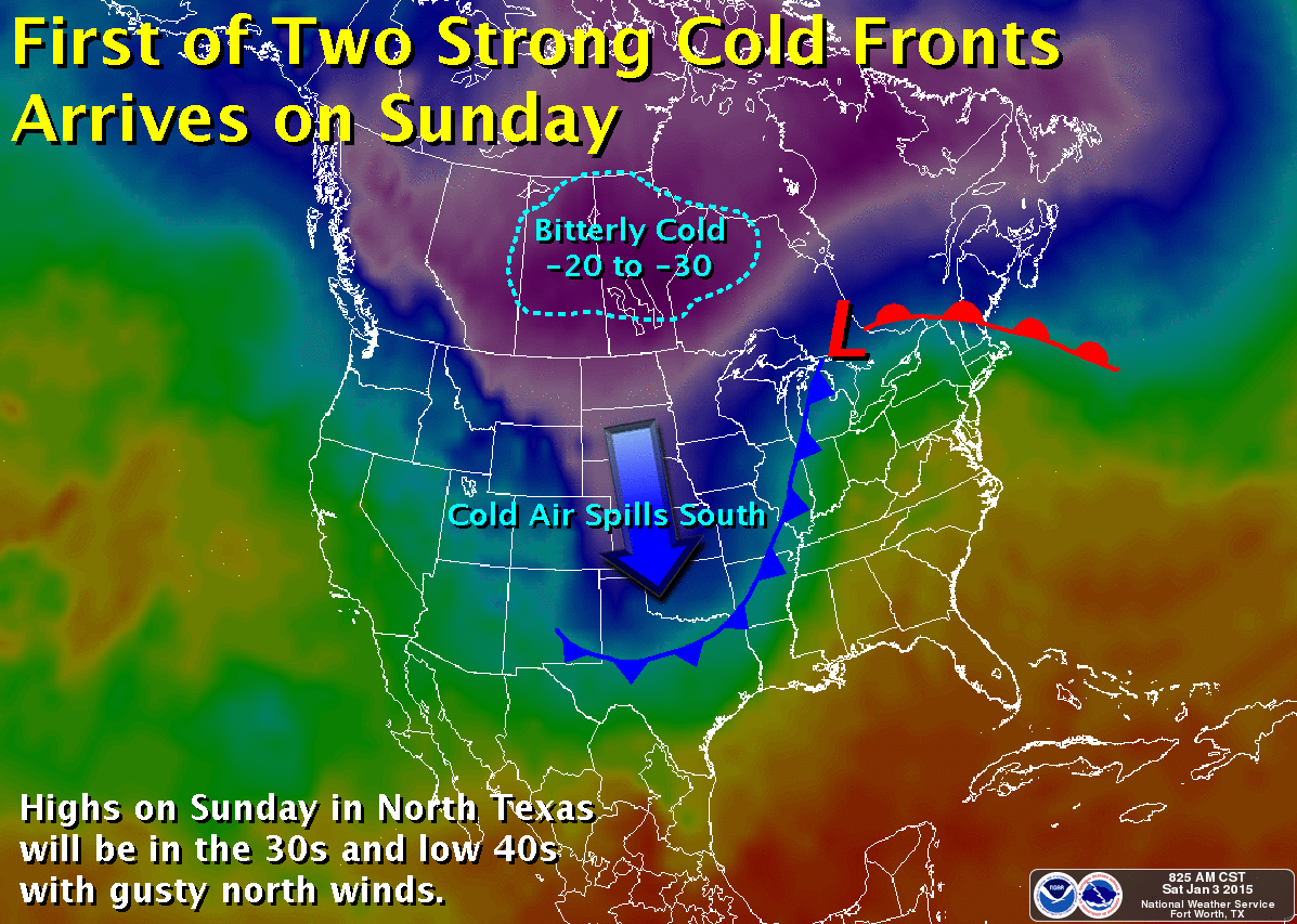
First of two Arctic cold fronts expected this week. Map courtesy of the National Weather Service office in Fort Worth, Tx.
The storm system that has brought all the ice to West Texas and all the rain to North Texas the last few days is now moving well off to the northeast. Rainfall amounts ranged a good 1 to 2 inches across the region. Enjoy the sun today and the southwest winds that will help temperatures warm into the 50s. It won’t last long! The first of two Arctic cold fronts will arrive tonight. Gusty northerly winds will usher in more Arctic air for tomorrow. Lows will plummet into the upper 20s by tomorrow morning with wind chill values down in the teens. It will be even colder Monday morning as high pressure, light winds, and radiational cooling help temps plummet into the upper teens to around 20°F.
Another, perhaps even colder, shot of Arctic air arrives on Tuesday. Some forecast models are depicting a 1060 mb surface high plummeting into the Plains with surface pressure approaching 1050 mb or 31.00 inHg in North Texas. It has been a long time since we have seen surface pressures anywhere near this magnitude in North Texas, and if true, would bring bitterly cold temperatures to boot. This is still a few days out and models can sometimes tend to over forecast surface pressures, but regardless it will be cold with lows likely by Thursday morning in the teens and lower 20s yet again. This is something we will continue to watch, if pressures do get as high as forecasted, surface temperatures would be even colder.
Unlike last week, this week will remain mostly dry with no threat of wintry precipitation, at least not right now. Unfortunately, the upper air pattern may remain highly amplified which could bring even more Arctic air to the region later in the month.
THE YEAR WILL END VERY COLD
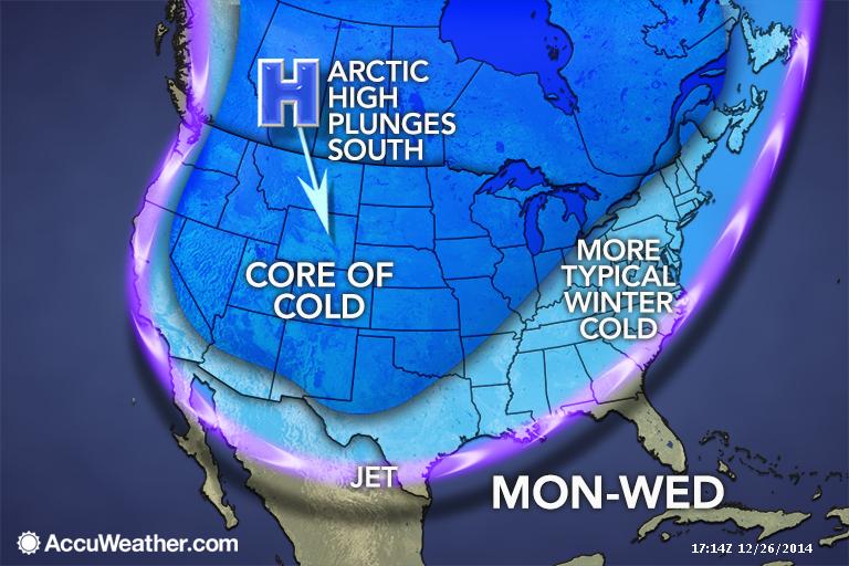
The Arctic gates swing wide open just in time for New Years as a massive 1055+ mb high plunges out of the Northwest Territories of Canada deep into Texas. Map courtesy of Accuweather.
Another Arctic airmass is set to plunge into the United States thanks to a highly amplified pattern. A huge ridge will build into Alaska with 560 dm heights building near 60 N. This will unlodge a dense Arctic airmass sitting over the Northwest Territories, indicative of a 1055+mb high pressure cell moving out of Canada into Montana. This will surge southward along the spine of the Rockies spilling deep into Texas. The Arctic front should arrive at DFW Tuesday morning, if not sooner, bringing with it drastically colder temperatures that will persist through New Year’s Day. At the same time, an upper low will be gathering in the four corners region. Depending on how this ejects out, could lead to precipitation problems across the State…stay tuned! It is too early to pinpoint exact details of just how cold it will be, but right now, New Year’s Eve day and night look to remain below freezing. So, bundle up if heading out to celebrate the New Year. The long-range guidance is pointing to a favorable synoptic pattern setup that could unleash more bitterly cold air as we head into January.
NEXT ARCTIC BLAST ON ITS WAY
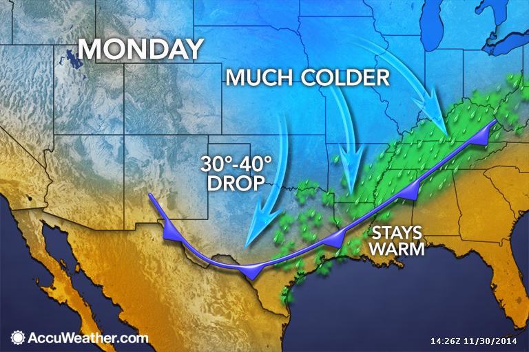
Arctic cold front expected to arrive in the pre-dawn hours at DFW. Map courtesy of Accuweather.
Residents of DFW should get out and enjoy the weekend, as it will be nice and warm for late November with temperatures pushing 80°F. All of this nice weather comes to an abrupt halt early on Monday as an Arctic cold front blasts through the area. Expect temperatures to be a good 35 to 40 degrees colder Monday and Tuesday from high temperatures experienced over the weekend. This Arctic airmass will be rather shallow as we are not expected to take the full brunt of the cold. It will stay to the north and slide off to the east rather quickly. This will make this Arctic blast rather short-lived, especially compared to the last one (not the same setup). By Wednesday, temperatures will be rebounding rapidly in a strong warm air advection pattern. The cold air will enhance lift across the area on Monday, thus low clouds and patchy drizzle will be the result. Areas northwest of the Metroplex may fall below freezing while the drizzle is falling, but impacts are not expected as extremely dry air in the upper levels should quickly shut off the drizzle. Lows by Tuesday morning should be below freezing area wide, probably in the 20s.