
A potentially significant severe weather episode is unfolding for the forecast area later this afternoon well into this evening. The Storm Prediction Center has placed the entire forecast area in the Enhanced Risk category for severe weather. Please see the map below. The Enhanced Risk area is in orange, the Slight Risk area is in yellow, the Marginal Risk area is in dark green, the lighter green area means non-severe convection is possible.
Setup: A powerful upper level trough will be digging into the western portions of the state. A dryline will setup ahead of this system and begin surging eastward. Copious moisture advection from the Gulf will be pulled northward, indicative of dewpoints surging into the upper 60s/70s. CAPE (convective available potential energy) values in this moisture laden, warm atmosphere will climb to around 3000 to 3500 J/Kg with shear in excess of 50 knots.
What to Expect: Discrete cells should begin firing along and ahead of the dryline and possibly as far east as the I-35 corridor late this afternoon. These will rapidly become severe producing gigantic sized hail in the Enhanced Risk area. It will be possible for hail to reach baseball, or even softball, size in this type of environment. Over time these cells should grow into a QLCS (quasi-linear convective system) and push eastward with an attendant damaging straight-line wind threat. With the discrete supercells, especially ahead of the dryline, a few tornadoes cannot be ruled out. The tornado threat should wane as the storms form into QLCS. Another line of storms may approach the area later tonight along the actual cold front.
When: Wednesday, April 17, 2019 between 5:00pm and Midnight.
Please stay alert to changing weather conditions and heed any possible warnings that may be issued for your location.
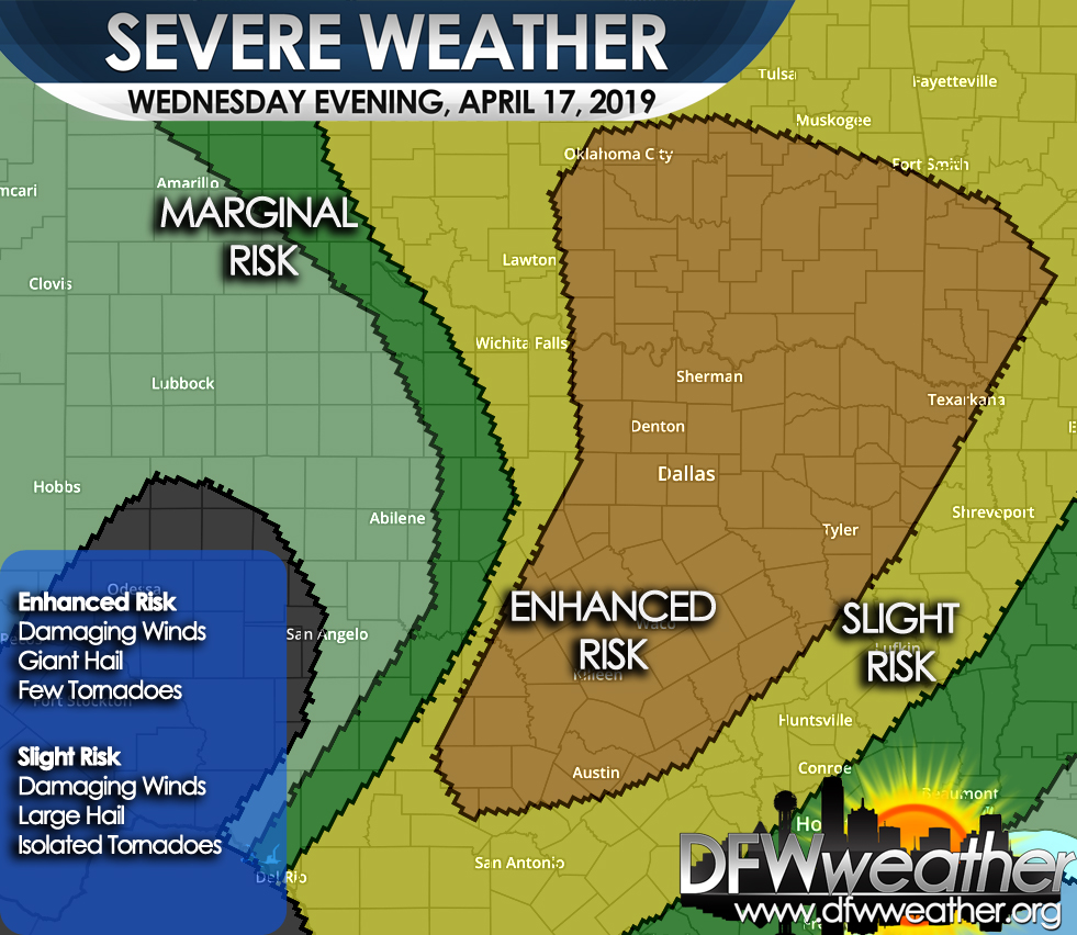
Storm Prediction Center severe weather outlook for Wednesday, April 17, 2019. Damaging winds, giant hail, and a few tornadoes are possible in the Enhanced Risk area which covers the entire forecast area.