
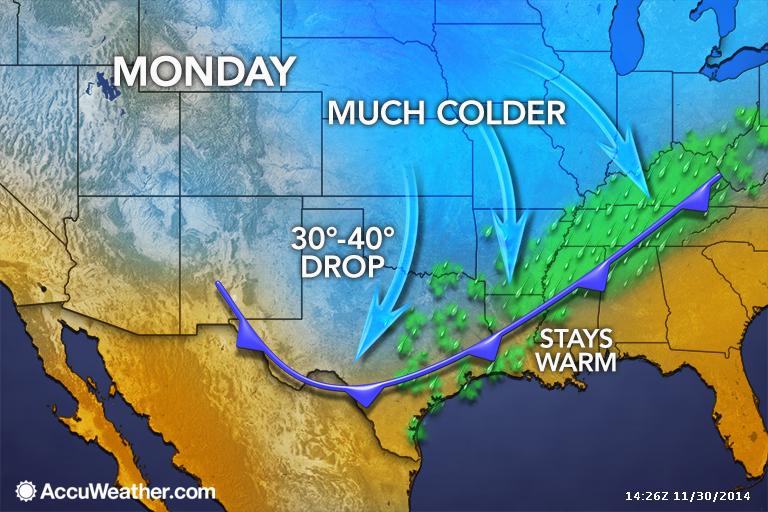
Arctic cold front expected to arrive in the pre-dawn hours at DFW. Map courtesy of Accuweather.
Residents of DFW should get out and enjoy the weekend, as it will be nice and warm for late November with temperatures pushing 80°F. All of this nice weather comes to an abrupt halt early on Monday as an Arctic cold front blasts through the area. Expect temperatures to be a good 35 to 40 degrees colder Monday and Tuesday from high temperatures experienced over the weekend. This Arctic airmass will be rather shallow as we are not expected to take the full brunt of the cold. It will stay to the north and slide off to the east rather quickly. This will make this Arctic blast rather short-lived, especially compared to the last one (not the same setup). By Wednesday, temperatures will be rebounding rapidly in a strong warm air advection pattern. The cold air will enhance lift across the area on Monday, thus low clouds and patchy drizzle will be the result. Areas northwest of the Metroplex may fall below freezing while the drizzle is falling, but impacts are not expected as extremely dry air in the upper levels should quickly shut off the drizzle. Lows by Tuesday morning should be below freezing area wide, probably in the 20s.